Save Our Street & Share Summit
Summit Avenue is Saint Paul’s treasured, historic street. SOS stands for Save Our Street because Summit belongs to all of Saint Paul, it is OUR flagship street. And people far beyond our capital city have signed our SOS petition and expressed their support.
We believe it’s important to ensure that Summit Avenue remains a viable corridor for everyone, pedestrians, bicyclists, and motorists for generations to come.

How You Can Help
Beyond voting, signing the petition, and adding a testimonial, we ask that all concerned citizens do the following:
Contact Decision-makers
Contact decision-makers at the city and state level and let them know how you stand on the issue.
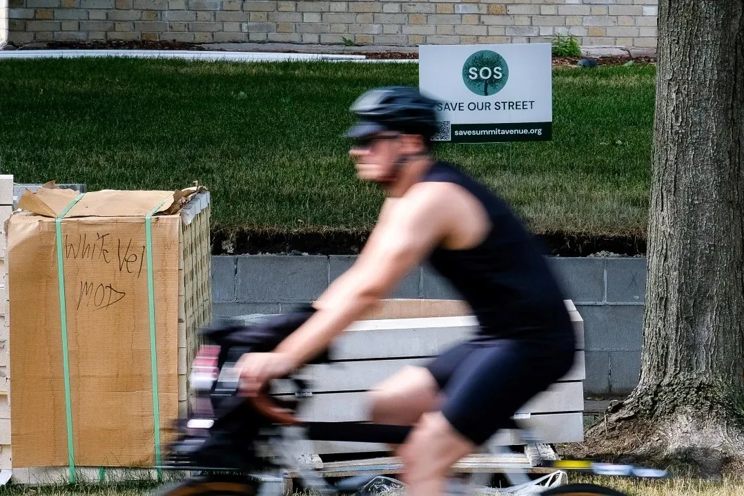
Show Your Support With a Yard Sign
#SaveSummitAvenue
Share your comments on social media using the hashtag #savesummitavenue
Upcoming Meetings
We encourage all members of our community to attend public meetings.
Recent Resources


What Is Being Proposed?
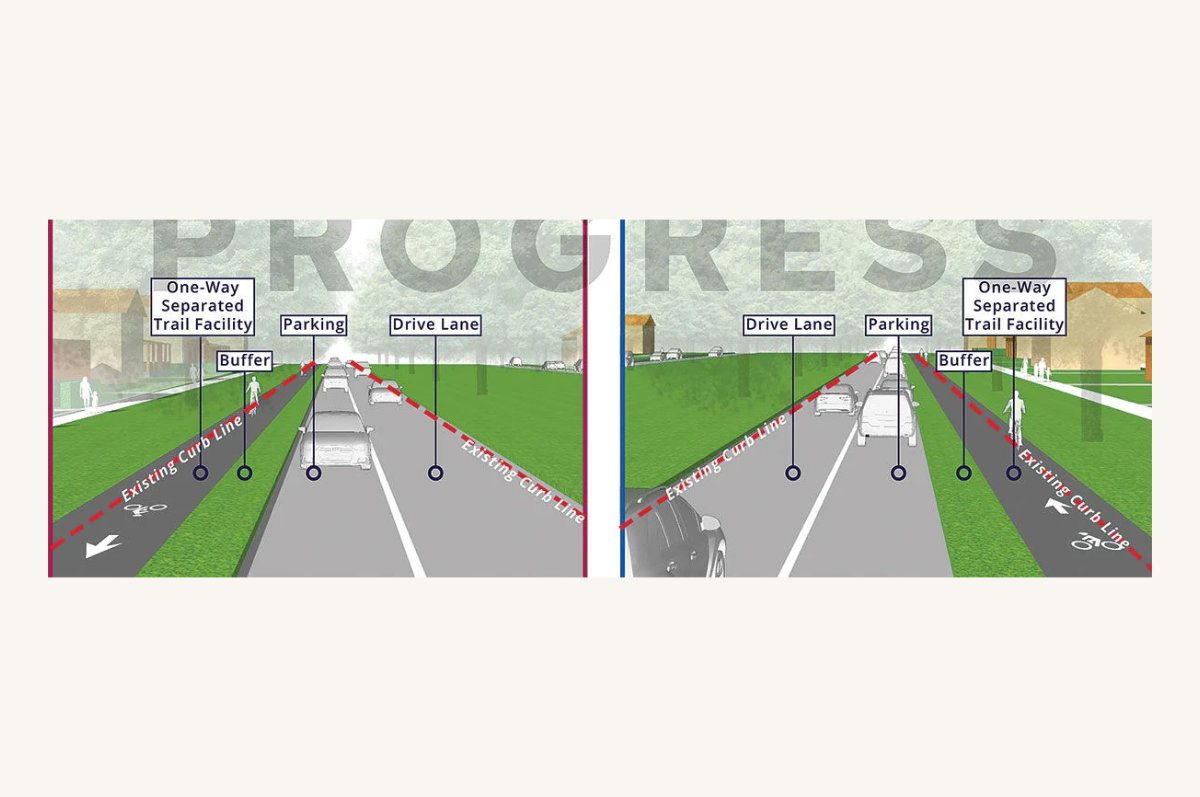
While details have not yet been finalized, the City has released general details surrounding a number of proposed design guidelines for constructing the trail. These include:
- Removing a significant amount of mature trees, forever altering the character of Summit Avenue. This will happen if the roadway is expanded 3+ feet, which is being proposed.
- Creating significant safety and logistical issues, such as those at where resident's driveways (150+) and the trail would intersect. And who would have the right of way at each of these intersections?
- Eliminating considerable amounts of parking (50%+ or more, in areas), which would affect people with accessibility issues, parents dropping off kids at school, people going to church, people visiting Summit Avenue, and residents on neighboring streets, among other issues
There are solutions that exist that do not involve impacting either trees nor parking.

The City’s 90% Draft Master Plan Has Been Released for the Summit Avenue Regional Trail
A draft of the City's 90% draft of the master plan is now available for public comment during the month of February. The draft document can be found online HERE for review. The document reflects about 90% progress. Please share your comments with City staff through this survey.
Our concerns remain and are heightened. Current design concepts call for significant tree loss, significant safety issues related to driveway, walkways, and side street intersections, and more significant loss of parking than we had anticipated. Please review and add your comments. Public comments will be accepted through February.
Summit Avenue brings tremendous value to Saint Paul and the region as a tourist and visitor destination, and as an urban oasis for Saint Paul residents…. all because the community has made Summit Avenue one of the best-preserved historic streets in the country. If you value protecting Summit Avenue as a viable corridor for pedestrians, bicyclists, and motorists for generations to come, please join us. Call your council member and let them know how you stand on the issue.
A Solution Searching For a Problem?
Who is this master plan intended to serve? Overall, what is the "point"? Is anyone in the bicycle community actually pushing for a regional trail on Summit? Why aren't other corridors, such as Marshall Avenue, being considered?
St Paul’s Fall 2021 survey demonstrates that more than twice as many respondents wanted a connecting route on Marshall compared to Summit. Marshall Avenue connects directly to Minneapolis via the Marshall-Lake Street bridge.

Significant Considerations
900+ Trees Are at Severe Risk
The city’s 90% bike trail plan shows the trail will cut into the grass boulevard and medians by 3 feet on both sides for over 62% of the length of the avenue. The increased risk to boulevard trees will be catastrophic, as well as loss of green space. The construction would kill the trees within 5 years.
Safety
How will the Regional Trail cross 151 driveways on the south side of Summit without significant disruptions? The City has stated that they will bring the driveways to the same grade as the trail, but is that realistic?
Historial Preservation
The avenue's marvelous vistas, park-like qualities, and a decades-long history of planning measures, civic participation, and private stewardship have kept Summit's unique character intact. The Regional Trail would destroy many of those special characteristics.
Parking and Accessibility
Accessibility for our most vulnerable populations will be drastically affected if street marking is drastically minimized (at best) or reduced altogether west of Lexington (at worst).
The Importance of Trees and Green Space
Summit Avenue is an urban parkland in the heart of the City. While the proposed regional trail plan suggests minimizing impact to trees, the plan designers are not adhering to guidance from arborists with urban experience.
“Trees are our largest source of green infrastructure and enhance the landscape by providing shade to homes, roads and parking lots, and provide color, beauty and character to the community.
Trees also provide benefits behind the scenes, such as the interception and storage of rainwater and carbon, the reduction of noise pollution and have proven to reduce crime and stress.”
(From the City of Saint Paul's Urban Tree Canopy Assessment)
In addition, research has shown that trees and greenery have a positive effect on life spans.
Outside of their visual appeal, research shows that trees:
- Improve physical and mental health
- Create stronger community ties
- Reduce crime rates
- Improve student performance
- Reduce energy use and bills
- Mitigate the Urban Heat Island effect
- Store and sequester carbon
- Are an important habitat
- Are an important source of infrastructure especially for storm water management
Research has Shown that Two Way Bicycle Lanes are Less Safe
Below are just a few of the safety and logistical issues that will arise if a separate Regional Trail is implemented:
How will driveways be dealt with?
There are 150+ driveways between Lexington and the Cathedral that have residents pulling out onto Summit that would intersect with a two-way bike paved/asphalt trail on the south side. This is not practical, especially considering the elevation changes between the trail and the driveways. An off-road trail will increase risks to cyclists by forcing them to cross hundreds of uncontrolled intersections with driveways and sidewalks; drivers are not used to traffic off the street and experience demonstrates this creates higher risk.
E-Bikes and Electric Scooters
E-bikes and electric scooters travel at a high rate of speed (up to 28 mph), and they would be traveling alongside regular bicyclists and other pedestrians on the sidewalk. This is not necessarily a safer solution to what is currently in place.

Research Has Shown That Two Way Bicycle Lanes Are Not Safer
Despite all the data showing how dangerous two-way paths are when placed along city streets with “high conflicts” from cross streets and driveways, the City put a 2-way option in the 30% Plan and the 60% Plan along several miles of Summit. In the 90% Plan, they removed the dangerous 2-way trail option from Summit, but it’s still included on Kellogg and Eagle Parkway — an even higher conflict street with much greater traffic volumes. It has to cross Shepard Road, Exchange Street, West Seventh and Kellogg at “Seven Corners” by the Xcel Center, and then cross Kellogg again to get to John Ireland Boulevard.
"...It's worth noting that there are some downsides to this type of infrastructure [2-way trails], however. Well, there's essentially one big downside. People in most countries of the world are in the habit of looking for oncoming traffic on their left when they are turning left, but two-way bike lanes result in bicyclists coming up from the far left on the back side. Copenhagenize's Mikael Colville-Andersen discussed this yesterday in an article that seems to be in response to the NITC findings but doesn't specifically mention the report. Here are some of his thoughts:
In Denmark, the on-street, bi-directional facility was removed from Best Practice for bicycle infrastructure over two decades ago. That in itself might be an alarm bell to anyone paying attention. These two way cycle tracks were found to be more dangerous than one-way cycle tracks on each side of the roadway. There is a certain paradigm in cities... I'm not saying it's GOOD, but it's there. Traffic users all know which way to look when moving about the city. Having bicycles coming from two directions at once was an inferior design.
This was in an established bicycle culture, too. The thought of putting such cycle tracks into cities that are only now putting the bicycles back - cities populated by citizens who aren't use to bicycle traffic - makes my toes curl.
He also references a December 2013 OECD report that advises against two-way bike lanes on the street. (Going through parks, the safety issues disappear of course.)
And he quotes Theo Zeegers of the Dutch national cycling organisation, Fietsersbond, in order to share his opinion on the matter: 'Bi-directional cycle tracks have a much higher risk to the cyclists than two, one-directional ones. The difference on crossings is about a factor 2. So, especially in areas with lots of crossings (ie. builtup areas), one-directional lanes are preferred. Not all municipalities get this message, however.'
So, you've got two conflicting points here: one is that two-way bike lanes are correlated with stronger bicycling growth than any other type of protected bike lane in this NITC report (more research needs to be done to confirm causation, not simply correlation), and second is that on-street two-way bike lanes are considerably less safe than on-street one-way bike lanes according to numerous bicycle planning experts and authorities.
The questions I'm left with are: Is it more worthwhile to attract people to bicycling than to build the absolute safest bike lanes? (Remember that bicycling also increases a great deal as ridership increases.) Is there any possibility two-way bike lanes could perform better in the US than in Europe? (I don't see why that would be the case.)
Mikael has a very clear opinion on this matter: 'If someone advocates infrastructure like this and actually believes it is good, they probably shouldn't be advocating bicycle infrastructure.'"
City Data Shows that Wheelock Parkway is just as Safe as the Current Bike Lane Configuration on Summit Avenue for Bikers and Pedestrians
See map comparing Summit Avenue (on-street lanes) and Wheelock Parkway (off-street trail) from the 2019 – 2022 crash data published on the City’s website.
More to Consider
There are many challenges around implementing a separate trail on any boulevard on Summit Avenue.
Winter Plowing and Maintenace
Where will the snow from Summit, from the trail and from adjacent sidewalks go? And will the trail really be maintained? There is an existing trail along 35E, the Little Bohemia Trail, that is not adequately maintained.
Street Parking
We cannot afford to minimize parking for Grand Avenue shops & restaurants, Summit Avenue churches and schools, Summit's many apartment residents, and more. Parking studies that are being referenced were conducted in the midst of the pandemic.
Economic Impact
In 2019, Ramsey County drew $2.3 Billion in tourism spending. Summit Avenue attractions make up an important part of this.

A Historic District Lost Cannot be Reclaimed
A regional trail that changes the features of what the community has invested so much to maintain threatens the Summit Avenue corridor. The historic streetscape brings tremendous value to the city and region as a tourist and visitor destination.
Why else would the city and state tourism offices promote its features? And why are residents drawn to this green oasis like a beckoning mirage away from the hustle and bustle of commercial business districts?
Many cities throughout the United States once had grand streets and boulevards throughout their cities, such as Prairie Avenue in Chicago, Euclid Avenue in Cleveland, Park Avenue in Minneapolis, and Fifth Avenue in New York City, to name a few.
All of these streets have at least lost a portion of their residential and historic character, except for Saint Paul’s Summit Avenue. The tree canopy, wide boulevards, slate curbs, and more greatly contribute to this historic character.
Tourist Attraction
Both Explore Minnesota and Visit Saint Paul tourism offices tout Summit Avenue’s distinct features.
In 2019, Ramsey County drew $2.3 Billion in tourism spending and the combined Minneapolis-Saint Paul region, $11.4 Billion. (Explore MN), which supports the City of Saint Paul preserving the distinct streetscape of the two National Historic Districts.
Historic Designations
The following districts exist on Summit Avenue.
Mississippi River to Oxford Street
This street is under the West Summit Avenue Historic District, and is in a National Historic District and Local Heritage Preservation District.
East from Ayd Mill Road
This stretch is in a State Historic District and in the Historic Hill District.
Oxford St. S – East
This stretch is in the Historic Hill District, a National Historic District, and a Local Heritage Preservation District.

Is The Current Bike Lane Set-Up Really That Bad?
No one disputes that the current roads desperately need to be improved, and that includes the bike lanes.
The current road conditions on Summit Avenue, including the bike lanes, are very poor. All residents would like to see improved roadways and it is hard to believe that everyone doesn't support better marked bike lanes. The lanes should be re-painted, and buffers should be added where possible, without reducing parking or greenspace.
In The News
Join the Discussion
What people are saying in the neighborhood. Share your comments below.
"Summit Ave is the bike commuters and bike riders best option. The current set up is what is the best set up for riders of all ages and commuters. I ride Summit daily and have for 40 years as a resident of St Paul and as a business owner in St Paul.
Summit is a glorious street to ride for the serenity, the beautiful homes and the lovely tree lined median. Summit despite its bad surface, big bike lanes are safe and efficient, and we don't have problems with cross traffic and intersections. I see joggers/runners and dog walkers walking the median enjoying the green places, trees and the soil! We have a great place for all! A mixed paved path will ruin a pleasured running and walking surface and have a bad impact on our treasured street.
Please leave Summit alone."


